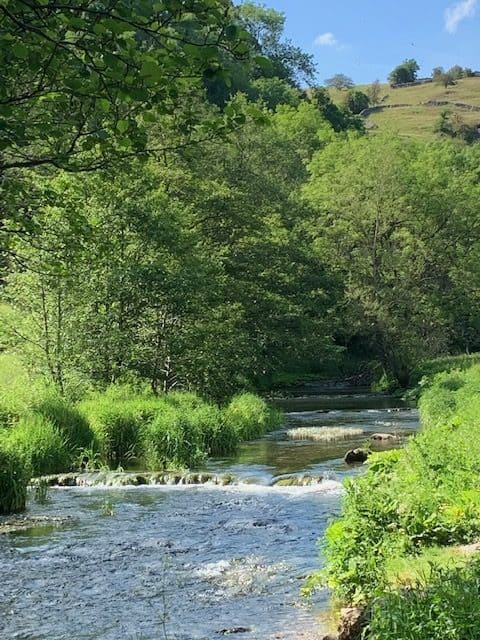
Dovedale walk – stunning scenery in Derbyshire
Lord Byron said of Dovedale, “I assure you there are things in Derbyshire as noble as in Greece or Switzerland” – today it is well known as a honey-pot tourist destination.

Dovedale is yet another example of the magical scenery just waiting to be explored by visitors to the Peak District National Park. Along the route there are no fewer than 6 stopping points to admire the scenery and learn more about its majestical beauty.
“Most visitors arriving at the lower reaches of Dovedale are content with a short stroll beyond the stepping- stones at the mouth of the dale. Scenically delightful though this may be, it is only a mere hint of the attractions further upstream, which this walk helps to explore.”
Location: Dovedale, Peak District National Park
Start and finish: Dovedale Car Park, Thorpe, DE6 2AY
What to keep an eye out for: Buzzards can often be spotted along the River Dove.
Distance: 6 miles
Time: 4 to 5 hours
Landscape: Rural
Directions to 1st stop: Thorpe Cloud and Bunster Hill
- From the car park turn right and walk up the road past the water company’s flow meter. Stop by the first bridge and admire the hills on either side. Thorpe Cloud to your right and Bunster Hill to your left guard the entrance to Dovedale. These hills were formed over 350 million years ago, by coral reefs, would you believe!
Directions to 2nd stop: The Stepping Stones
- Continue walking and follow the west bank of the River Dove beneath Bunster Hill to the famous stepping-stones, a real honey-pot destination for tourists, attracting more than a million visitors each year who capture some great photos as a memento of their visit. The square cut stones which exist today were put in around 1890 when Victorian tourists would arrive and be transported across the stones by hiring a donkey that had been stationed there to transport visitors further into the dale. Whilst the donkeys are no longer present, Dovedale and its stepping- stones are still known today as a ‘must see’ on the tourist map of the Peak District.

Directions to 3rd stopping point: Lover’s Leap
- Once across the river, the path passes through a double squeezer stile and winds up on rock steps to the first major viewpoint of Lover’s Leap. Steps then lead down through the trees from Lover’s Leap. A few steps further on and high up to the right you can see the natural arch of Reynard’s Cave. Whilst you may wish to scramble up here, it has eroded considerably and is slippery, so caution is advised here.
Lover’s Leap is another reef limestone whose name was acquired, so legend has it, from a rejected girl who had attempted to jump, yet was thankfully saved by her billowing skirts!
The steps up to the high point for the vantage view were built by Italian prisoners of war during World War Two.
Reynard’s Cave, behind the arch is known as Reynard’s kitchen as it was home to some of our prehistoric ancestors. In 2014 there was a significant find of late Iron Age and pre-Conquest Roman coins found here.
Directions to 4th stopping point: Ilam Rock and Pickering Tor
- The Dale narrows here to a section known as The Straits. Here you will find the footpath has been raised on wooden duckboards above the river’s level. The path passes directly under the Lion’s Head Rock until the Dale opens out slightly where a footbridge crosses to Ilam Rock.
These delicate fingers of rock, to be seen on opposite banks of the Dove, are a truly spectacular highlight of the Dale. JMW Turner captured this in one of his paintings, bolstering today’s tourists’ pique in the Dales.
Directions to the 5th stopping point: Viator’s Bridge
- Follow the path which now meanders east opposite Hall Dale, passing the water-worn cavities known as Dove Holes. The path passes several weirs before opening to a gentle meadowland path taking you into the hamlet of Milldale, reached by crossing the narrow Viator’s bridge.

Formally a packhorse bridge, now known as Viator’s bridge, deriving from a passage taken from the classic book The Compleat Angler published in 1653, it is much praised for its qualities as a fishing river. Glimpses of grey wagtail or a kingfisher may be spotted here by a keen visitor or look carefully in the crystal- clear waters and you may well spot a rainbow and brown trout too.
Directions to the 6th and final stopping point: Milldale
- Cross Viator’s bridge and follow the road into the pretty village of Milldale and your walk through Dovedale is complete – we hope you enjoyed it.
You can now return the same way and enjoy all the scenery on your return to Dovedale car park.

© Copyright 2022 | All Rights Reserved
For more ideas and inspiration of other walks, including Buxton Country Park and Solomon’s Temple in Buxton or to know more about the area of The Peak District with places to visit and historical sites to see just visit our website here or for further information on Dovedale walks click here.

Download your FREE GUIDE to the Great places to eat in Buxton.
Just click on the image.


